Survey Areas (Worldwide)
Based on the research for this dissertation, cave observations I have taken myself, and the work conducted by Vandevelde and colleagues, I have compiled an interactive GIS map with the sites and currently estimated ages of their corresponding Carbonaceous Material Speleothem remains.
Green – Where Fuliginochronology has been utilised.
Blue – Where Carbonaceous Material has been discovered and talked about.
Orange – Sites that have some potential based on archaeological evidence and the mention of such evidence like a hearth.
Red – Where passing comments, in person and in older publications such as (SMELL) have been talked about and require further investigation to verify for Carbonaceous Material preservation.
Black – Other, needs further investigation into the cave/region.
NOTE -There is currently a slight issue with my server resources and as such, the map is not always showing the correct information. Below is a quick GIS map of the four cave locations of which samples have been taken.
Research Area
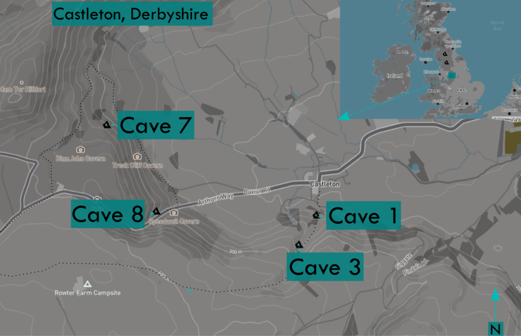
The location of the four caves used in the recent study for my dissertation and further research into speleothems in archaeology.
Research Scans
Below are four scans of the caves that appeared in my research; these were conducted by myself using a blend of photogrammetry and LIDAR.